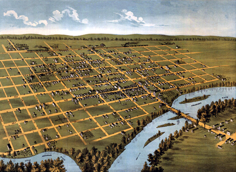
This 1873 “bird’s eye view” map of Wichita shows just how little there was to the city at the time. The Occidental Hotel — still standing today at Main & Second — and the first homes of J.R. Mead & “Dutch Bill” Greiffenstein are represented here.
Throughout the bulk of human history, our perspective has been largely limited by virtue of the fact that we have but two eyes, arranged no more than about two yards above ground level. One might climb a hill or, as mankind’s engineering skill increased, a tall building, but a true “bird’s eye view” was only made possible with the advent of human flight, a fairly recent development.
Illustrated “panoramic” city maps became all the rage in America in the latter half of the 19th Century, showing proud citizens the sprawl of their growing communities in fine detail. Some of the artists who created these were lucky enough to have access to hot air balloons in order to survey the areas they were to depict; other less fortunate cartographers had to rely on creative technique.
As film photography became more sophisticated and its attendant equipment and paraphernalia less bulky and cantankerous, the practice of aerial photography flourished, almost immediately replacing forever the hand-illustrated map with actual images captured from on high in balloons, and later, airplanes. Today the best satellite images boast resolution of about 16 inches, taken from over 400 miles above the Earth.
These images show how much Wichita has changed from 1873 to today, from points of view our forefathers could only imagine.
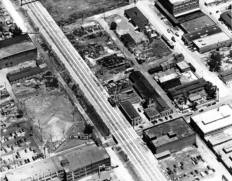
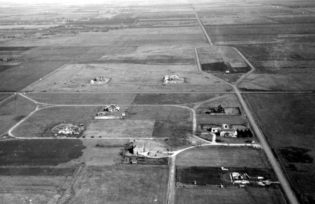
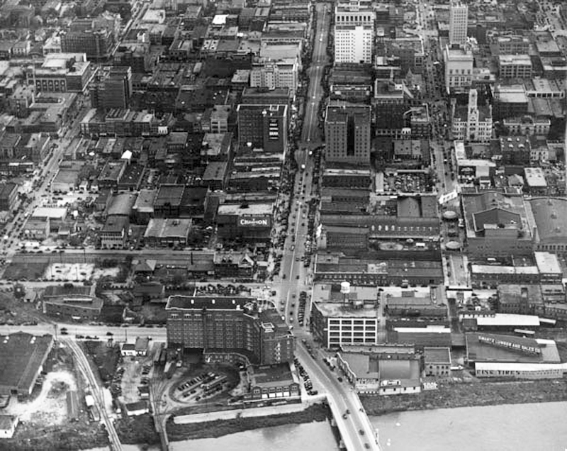
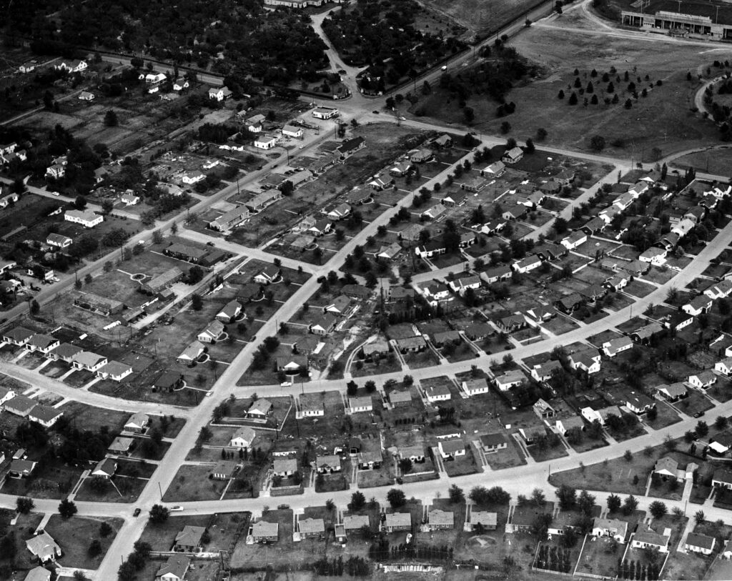
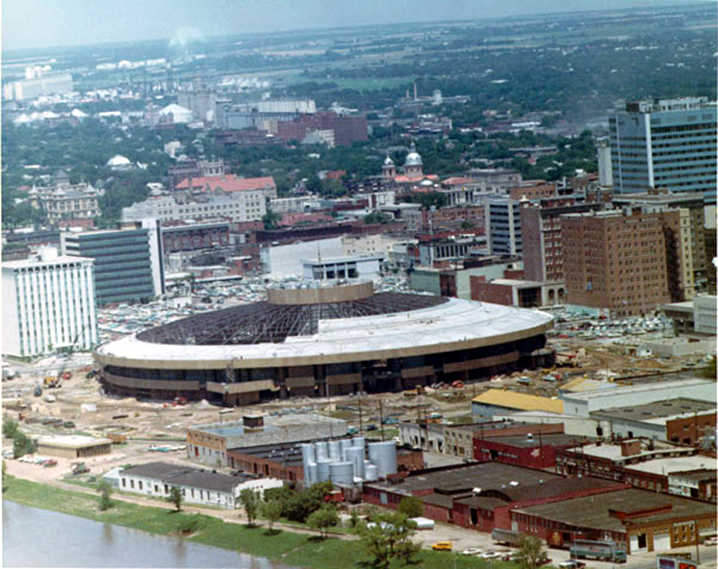
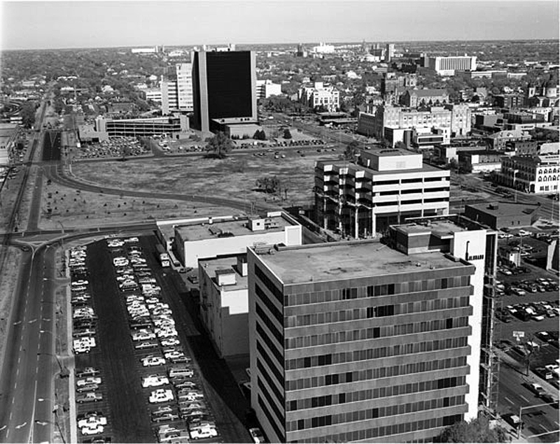
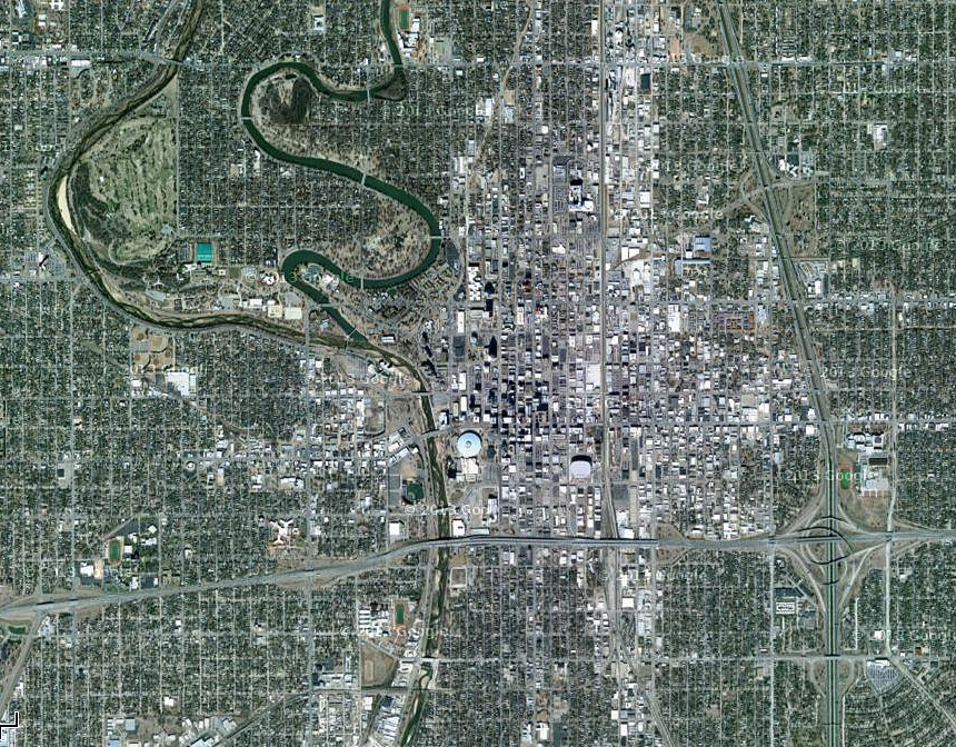
Old Town Square is now a popular spot for shopping and entertainment, but in 1928 it was the heart of Wichita’s downtown industrial zone. The building at extreme lower left is the no-longer-extant Coleman factory; in the upper right corner is the International Harvester building, recently renovated into living space and known as Harvester Lofts.Looking east from roughly First and Edgemoor toward the intersection of Douglas & Woodlawn in 1929. The forked road at middle right is Douglas Avenue where it runs through Eastborough; the extreme upper right corner is today the spot where Towne East Square stands. Downtown Wichita as seen looking east from Delano, 1936. That’s Douglas Avenue running vertically down the center of the image, with the Arkansas River at the bottom. Note the AVI train yard at the rear of the Broadview Hotel in the foreground (see previous article).Shady Brook Addition is seen here in this 1952 photo, looking northeast toward the intersection of 21st & Hillside. At top right is Veterans Field on Wichita University’s campus, roughly where Charles Koch Arena stands today; at top left is Old Mission Cemetery. Though developed with an eye to the “City Beautiful” urban planning movement, Shady Brook fell victim to “white flight” in the wake of legislation such as the Fair Housing Act of 1968, and the area has ever since faced decades of economic disinvestment.Construction of Century II was well underway in this 1968 photo. Everything in the foreground, not to mention a fair amount in the visible background, has been radically changed since. Looking north from the corner of Water & First in 1982 reveals the vast empty space where the Epic Center stands today. The original plan called for the construction of two buildings on the lot, mirroring one another, but economic turmoil and worries about creating a glut of empty office space downtown in an era of suburban flight pared the project down to a single tower. Construction on the Epic Center, still the tallest building in the state, was completed in 1987. A current (2006) view of downtown Wichita as seen from space.
Wichitarchaeology is a series of Wichita history columns originally posted in F5 Weekly. These articles are being presented here as they originally appeared, in some cases with additional photos, supporting links and/or addenda providing updated information.Unless otherwise identified, photographs courtesy of the Wichita-Sedgwick County Historical Museum. This post was first published 6/6/2013.